Know when the shot is best — not just whether you can fly.

More than thirty things decide whether a flight is legal and safe. FlyDrone checks every one — then ranks the hours worth flying.

User Guide

The core

Every source in. One answer out.

Every feed a pilot would check by hand streams into one core. It weighs them together and hands back the calls that matter.

Airspace & legal

  • FAA UASFM grid ceilings & the LAANC route
  • Live TFRs + national-defense zones
  • NPS boundaries, park & city rules
  • Stadiums & game schedules
  • Airports, ATIS, helipads

Weather & sky

  • Wind at the ground and aloft, gusts
  • Cloud, visibility, precipitation
  • Cloud forecast tiles
  • Sun position & golden light
  • GPS & space weather (Kp)

Ground & hazards

  • Terrain elevation
  • Towers & obstacles
  • Wildfire perimeters & smoke
  • Air quality
  • Crime feeds

Logistics

  • Live traffic & drive time
  • Parking near launch spots
  • Community spots

Pilot profile

  • Drone fleet: wind limit, cameras, lenses
  • Shooting preferences: light, time of day, sky
  • Interests: what you hunt for, for the Spot finder
FlyDrone PlannerCORE
Free

Can I fly here, and when?

  • Go / caution / no-go for any spot, with every reason
  • The legal ceiling over your launch point, and the LAANC route
  • Wind at the ground and at 400 ft, against your drone's limit
  • The best hour of the next 24, every hour scored
  • Golden and blue hour, and the sun's line on the map
  • Points of interest: viewpoints, parking, restrooms
  • A 37-item pre-flight checklist
Hobby

How do I shoot it?

  • Exposure, ND filter and white balance for the light at that hour
  • Gimbal and flight speeds for the shot, ready for DJI Fly
  • Two days ahead, the three best windows
  • Drive time from Home in live traffic
  • Where other pilots launch: community spots
  • + Everything in Free
Pro

Plan the whole shooting day

  • Real launch spots found for you, around Home or on the way
  • The day's route: best order and times for up to 7 stops
  • Where to stand for the frame: distance, altitude, shooting ring
  • Ceiling and line of sight at any point on the map
  • The brief, read aloud
  • Which of your drones can fly the hour
  • A week ahead, up to five windows
  • + Everything in Hobby

Watch

Video tutorials

FlyDrone Planner introduction

Three questions before every flight — may I fly here, when is it worth it, what will the shot look like — and how the app answers them, from the first point on the map to a planned shooting day.

Getting started

Where to start: signing in, the screen, a first check of a launch point, the timeline, and a tour of every Settings section, on the Free plan.

Points on the map

Which point you are moving: the launch point and the ceiling above it, the wind arrows and the sun ray, Home 1 and Home 2, what search moves, and the modes that arm a click.

Reading the verdict

More than thirty checks for the spot and the hour: the five levels, the reasons hardest first, what a failed source does, and what the verdict leaves to you.

Timeline and best windows

The timeline is the app's clock; Best windows says when it is worth flying: the score, how a window is built, Shooting preferences and the sun fan.

Airspace and restrictions

The FAA grid and how your square is authorized, TFRs hour by hour, stadium game days, National Park Service land and city parks, restricted zones and helipads.

Weather, light and hazards

Wind against your drone's limit, the cloud base and the 500 ft rule, rain, air quality, wildfires and smoke, GPS and the Kp index, and the light from golden to blue hour.

Camera, movement and your fleet

Camera settings down to the ND filter for the light at your spot and hour, movement settings as numbers for DJI Fly, and the drones in My fleet.

Map layers and the legend

Every layer and what it draws, why one looks empty when zoomed out, points of interest, the legend, Map, Satellite and Terrain, 3D buildings, and Hide all.

My spots and the community

Saving a spot, its score and distance, sorting and moving spots, names and notes, and the anonymous community layer of where other pilots save theirs.

Shot planner

Pick a subject and the app solves the framing: where the drone hovers, how high, what the camera sees, the ring of legal and sun-lit positions, and the ceiling that follows the drone.

Altitude explorer

The law measures 400 ft above the ground under the drone; your controller measures from takeoff. The probe turns one into the other near hills.

Spot finder

AI scouting for a shooting day: up to seven real launch spots, each a public parking lot next to a subject worth filming, checked against the verdict first.

Trip planner

A whole shooting day: up to seven stops ordered and timed against predicted traffic, with the forecast and the light at each stop.

On location

At the launch point: drive time with live traffic, PIC here, the facing compass, the pre-flight checklist, the Spoken brief, and larger text for bright sun.

Plans and your account

What every plan gets, what Hobby and Pro add, buying on the web or in the apps, and Settings: sign-in methods, reset, account deletion, units and support.

Who it's for

Who flies with FlyDrone

Fly for pay and you fly under Part 107, whatever you shoot; fly for fun and the recreational rules apply. Near airports both need FAA authorization, and the brief shows how to get yours: an instant LAANC approval, further coordination, or an application through FAA DroneZone.

Commercial · Part 107

Real estate & property

Deliver the listing shoot in one trip.

  • Preview the frame: the real house in 3D, lit by the sun at the hour you pick
  • Which side is in the light, and when to shoot it
  • Ceiling and LAANC route near city airports
Pro

Commercial · Part 107

Film & content creators

Be there when the light is.

  • Exposure, ND filter and white balance for the light you'll have
  • Gimbal and flight speeds for your shooting style, ready for DJI Fly
  • Golden and blue hour, and the best windows two days ahead
HobbyPro

Commercial · Part 107

Inspections, mapping & survey

Know before the crew rolls out.

  • Which of your drones can fly the hour
  • Ceiling and line of sight anywhere on site
  • A week ahead to book the job
Pro

Recreational

Hobbyists & students

Fly legally, and learn why.

  • A clear verdict with every reason
  • Park, NPS and stadium rules on the map
  • A 37-item pre-flight checklist
FreeHobby

Also flying with it: news crews, event videographers and security teams.
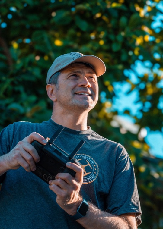
Sergey, FlyDrone's founder, in the field with his drone

From the field

Built in the field

Airspace, TFRs, weather, clouds and fog, wind at the ground and aloft, the sun's direction and UV, golden hour and sunset time, temperature, air quality and visibility, parks and restricted zones, helipads and uncontrolled airfields, stadiums on game days, launch spots and line of sight: a pilot checks them in a dozen different apps and websites, and each speaks its own language. I built FlyDrone to make them answer one question together: is this hour worth flying? I fly with it every week.

— SERGEY · FAA PART 107 PILOT & FLYDRONE FOUNDER

Pricing

Simple pricing

Paid plans start with a 7-day free trial. Cancel anytime.

Free

$0
FOREVER
  • Go/no-go verdict for any spot: FAA airspace & LAANC ceiling, live TFRs, parks, restricted grounds, stadium game days, wildfires & smoke, helipads & airfields
  • Weather for your drone: wind at ground & 400 ft against its wind limit, gusts, clouds & fog, rain, visibility, temperature
  • Air quality, GPS satellites & Kp index
  • Sun: sunrise, sunset, golden & blue hour, sun ray on the map
  • The best window to fly in the next 24 hours, every hour scored
  • Map layers, points of interest, 3D terrain, the legal ceiling over your launch point
  • Pre-flight checklist (37 items)
  • 5 new spot analyses a day · 5 saved spots

Hobby

$3.99/mo
OR $34.99/YR — SAVE 27%
  • Everything in Free
  • Camera settings: exposure, ND filter, white balance for the light at that hour
  • Movement settings: gimbal & flight speeds for the shot, ready to dial into DJI Fly
  • Which way I'm facing: compass ray from where you stand (phone or tablet)
  • Drive time from Home with live traffic · traffic layer
  • Community spots layer
  • 48-hour forecast · up to 3 recommended windows
  • 50 spot analyses a day · 20 saved spots

Pro

$8.99/mo
OR $79.99/YR — SAVE 26%
  • Everything in Hobby
  • Spoken brief: the verdict, why, and the numbers you pick, read aloud
  • Shot planner: distance, altitude, shooting ring on the map, frame preview
  • Altitude explorer: probe any point for its ceiling, controller reading, line of sight
  • AI Spot finder: real launch spots around either Home or between them
  • Trip planner: best order and times for up to 7 stops, with traffic; saved routes
  • Home 2 and one-way days
  • Sun path across the shoot window
  • Multi-drone fleet: which of your drones can fly the hour you pick
  • Up to 7-day forecast · up to 5 recommended windows
  • Unlimited spot analyses · unlimited saved spots · private spots

Coverage

United States only, for now.

FlyDrone checks US airspace against US rules. Other countries will be added later.

  • NowUnited States — FAA airspace and LAANC, TFRs, parks and state drone laws
  • LaterOther countries, each with its own airspace and rules

One account

One account, every screen.

Sign in with Google or Apple on the web, iPhone, iPad or Android.
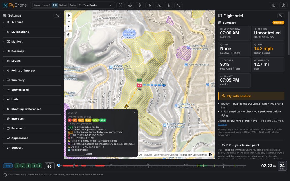
FlyDrone on the web: the map and the flight brief for Twin Peaks
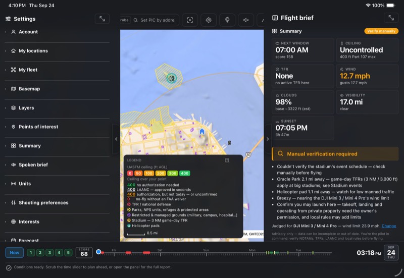
FlyDrone on an iPad: the same spot with settings and the brief beside the map
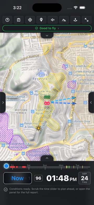
FlyDrone on a phone: the same spot, Good to fly
WebiPhone & iPadAndroid

Plan the whole working day ahead on your laptop's big screen: the spots, the hours worth flying and the route between them. On the road, open the same account on your phone or tablet, and the spots and day plans you saved are already there.

Download on the App StoreGet it on Google Play